
Lake Arrowhead Guidebook
Things to Do
An adventure "theme park" with lots of activities including a bike park, ice skating, zip line, ax throwing, archery, and more!
564 residents recomanen
SkyPark al poble de Santa
28950 CA-18An adventure "theme park" with lots of activities including a bike park, ice skating, zip line, ax throwing, archery, and more!
Take a trip to the lake and visit shops and restaurants at the village.
465 residents recomanen
Poble de Lake Arrowhead
28200 CA-189Take a trip to the lake and visit shops and restaurants at the village.
Jump the Queen boat and tour Lake Arrowhead on the water.
200 residents recomanen
Arrowhead Queen Tour Boat
28200 CA-189Jump the Queen boat and tour Lake Arrowhead on the water.
If you have never been water skiing and want to learn, McKenzie Water Ski School is the place for you. Their instructors have extensive training and experience to teach you how to get up and skiing on your own with in minutes. One ski, Two Skis, or Wakeboarding, whatever you want to learn they are here to help you achieve your goals and have fun doing it.
71 residents recomanen
McKenzie's WaterSki School
If you have never been water skiing and want to learn, McKenzie Water Ski School is the place for you. Their instructors have extensive training and experience to teach you how to get up and skiing on your own with in minutes. One ski, Two Skis, or Wakeboarding, whatever you want to learn they are here to help you achieve your goals and have fun doing it.
The Mountain History Museum
27176 Peninsula DrLearn about the history of the mountain!
Ski Resorts
Snowboard or ski in the winter. 29.6 miles or approximately 1 hour from the house.
119 residents recomanen
Big Bear Mountain Resort
880 Summit BlvdSnowboard or ski in the winter. 29.6 miles or approximately 1 hour from the house.
Ski or Snowboard in the winter. 16.7 miles or approximately 30 minutes from the house.
347 residents recomanen
Snow Valley Mountain Resort
35100 CA-18Ski or Snowboard in the winter. 16.7 miles or approximately 30 minutes from the house.
Ski or snowboard in the winter. 29.6 miles or approximately 1 hour from the house.
906 residents recomanen
Snow Summit
880 Summit BlvdSki or snowboard in the winter. 29.6 miles or approximately 1 hour from the house.
Lakes & Hot Springs
Camping, Fishing, Day Use, Swimming and Boat Rentals. Check website for details. 13 miles or approximately 45 minutes from the house.
16 residents recomanen
Silverwood Lake State Recreation Area
14651 Cedar CirCamping, Fishing, Day Use, Swimming and Boat Rentals. Check website for details. 13 miles or approximately 45 minutes from the house.
Swim at Lake Gregory. Check website for details.
216 residents recomanen
Parc Regional del Llac Gregory
24171 Lake DrSwim at Lake Gregory. Check website for details.
Camping, Hiking & Hot Springs. Check website for details.
75 residents recomanen
Deep Creek Hot Springs
Pacific Crest National Scenic TrailCamping, Hiking & Hot Springs. Check website for details.
Green Valley Lake
Hiking
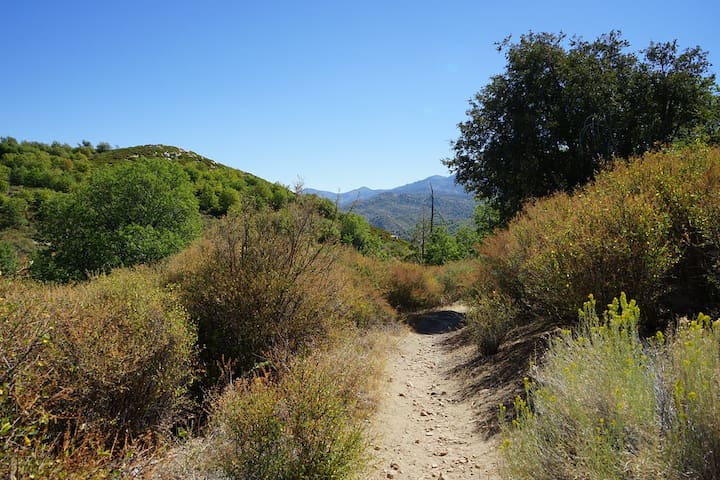
The Pacific Crest Trail or PCT is a 2,600 mile trail that spans from Mexico to Canada. Approximately 40 miles of this trail
crosses the Mountaintop Ranger District. Adventure Pass required at Splinter’s Cabin.
• Mission Creek Trail Camp to Coon Creek Jump Off – 6.6 miles, moderate
• Coon Creek Jump Off to Onyx Summit – 5.7 miles, moderate
• Onyx Summit to Forest Road 2N02 – 9.4 miles, strenuous
• 2N02 to Dump Rd. 3N08 – 6.2 miles, moderate
• Dump Rd. to Van Dusen Road 3N09 – 6.9 miles, moderate
• 3N09 to 3N12 – 6.3 miles, moderate
• 3N12 to Little Bear Springs – 4.4 miles, moderate
• Little Bear Springs to Crab Flats Road – 6.5 miles, moderate
• Crab Flats Road to Deep Creek Bridge – 6.0 miles, moderate
• Deep Creek Bridge to Devils Hole – 5.0 miles round trip, moderate
• Devils Hole to Mojave River Dam – 13.0 miles, Very strenuous
• Mojave River Dam to Cedar Springs Dam – 9.4 miles, strenuous
• Cedar Springs Dam to Silverwood Entrance – 6.0 miles, moderate
• Silverwood Lake to Elliot Road – 9 miles, strenuous
• Elliot Road to Cajon Pass – 4.5 miles, moderate
39 residents recomanen
Pacific Crest Trail
The Pacific Crest Trail or PCT is a 2,600 mile trail that spans from Mexico to Canada. Approximately 40 miles of this trail
crosses the Mountaintop Ranger District. Adventure Pass required at Splinter’s Cabin.
• Mission Creek Trail Camp to Coon Creek Jump Off – 6.6 miles, moderate
• Coon Creek Jump Off to Onyx Summit – 5.7 miles, moderate
• Onyx Summit to Forest Road 2N02 – 9.4 miles, strenuous
• 2N02 to Dump Rd. 3N08 – 6.2 miles, moderate
• Dump Rd. to Van Dusen Road 3N09 – 6.9 miles, moderate
• 3N09 to 3N12 – 6.3 miles, moderate
• 3N12 to Little Bear Springs – 4.4 miles, moderate
• Little Bear Springs to Crab Flats Road – 6.5 miles, moderate
• Crab Flats Road to Deep Creek Bridge – 6.0 miles, moderate
• Deep Creek Bridge to Devils Hole – 5.0 miles round trip, moderate
• Devils Hole to Mojave River Dam – 13.0 miles, Very strenuous
• Mojave River Dam to Cedar Springs Dam – 9.4 miles, strenuous
• Cedar Springs Dam to Silverwood Entrance – 6.0 miles, moderate
• Silverwood Lake to Elliot Road – 9 miles, strenuous
• Elliot Road to Cajon Pass – 4.5 miles, moderate
Fisherman’s Camp Trail (2W07) Moderate/Difficult 2.5 miles
This trail begins 1.3 miles west of Crab Flats Campground on Forest Service Road 3N34; Crab Creek Trail provides the
primary access to Fisherman's Camp (a group reservation trail camp) on Deep Creek. The trail descends moderately
westward crossing Crab Creek 1.3 miles from Deep Creek. Deep Creek must be forded to reach Fisherman's Camp.
Attempting to cross Deep Creek when it is running high can be dangerous. The scenery along this trail is exceptional;
Camping at Fisherman's Camp is by group permit only. Make reservations at least 3 days in advance at recreation.gov
Fisherman's Camp Trail Head
South Main DivideFisherman’s Camp Trail (2W07) Moderate/Difficult 2.5 miles
This trail begins 1.3 miles west of Crab Flats Campground on Forest Service Road 3N34; Crab Creek Trail provides the
primary access to Fisherman's Camp (a group reservation trail camp) on Deep Creek. The trail descends moderately
westward crossing Crab Creek 1.3 miles from Deep Creek. Deep Creek must be forded to reach Fisherman's Camp.
Attempting to cross Deep Creek when it is running high can be dangerous. The scenery along this trail is exceptional;
Camping at Fisherman's Camp is by group permit only. Make reservations at least 3 days in advance at recreation.gov
Seeley Creek Trail (4W07) Easy 1 mile
This short trail begins on Forest Service Road 2N03 - 1/4 mile south of the entrance to Camp Seeley on Highway 138. You
must cross the creek. This easy hike follows Seeley Creek to an overlook called "Heart Rock" which marks the trail's end.
Here there is a heart-shaped hole in the cliff next to a picturesque 20-foot waterfall. The gentle grade of this trail makes it an excellent walk for all ages, but be careful to watch out for the safety of children near the waterfall.
Seeley Creek Nordic Ski Trails
Morrell Creek RoadSeeley Creek Trail (4W07) Easy 1 mile
This short trail begins on Forest Service Road 2N03 - 1/4 mile south of the entrance to Camp Seeley on Highway 138. You
must cross the creek. This easy hike follows Seeley Creek to an overlook called "Heart Rock" which marks the trail's end.
Here there is a heart-shaped hole in the cliff next to a picturesque 20-foot waterfall. The gentle grade of this trail makes it an excellent walk for all ages, but be careful to watch out for the safety of children near the waterfall.
North Shore Recreation Trail (3W12) Moderate to Difficult 1.7 miles. This trail is best reached by starting at the beginning of FS Road 2N25 between North Shore Campground and Papoose Lake. To reach 2N25, turn east on Torrey Road opposite the Lake Arrowhead Marina. Turn at first left and follow the dirt road 112 mile to where you reach the trail head on the east (right) side of 2N25. The trail descends gently through a mixed conifer forest and settles finally along Little Bear Creek where you will reach FS Road 2N26Y after 1 mile.
Northshore National Recreation Trail /
Northshore National Recreation Trail /North Shore Recreation Trail (3W12) Moderate to Difficult 1.7 miles. This trail is best reached by starting at the beginning of FS Road 2N25 between North Shore Campground and Papoose Lake. To reach 2N25, turn east on Torrey Road opposite the Lake Arrowhead Marina. Turn at first left and follow the dirt road 112 mile to where you reach the trail head on the east (right) side of 2N25. The trail descends gently through a mixed conifer forest and settles finally along Little Bear Creek where you will reach FS Road 2N26Y after 1 mile.
Little Green Valley Trail (2W10) Difficult 1.5 miles
This trail begins on the north side of Highway 18 between the two entrances to Snow Valley Ski area. Little Green Valley
Trail climbs steeply to the north until you reach a meadow at Forest Service Road 2N19. This trail provides you with
outstanding views of Snow Valley and Slide Peak. The trail ties into 1W26, then to 2N64 which the Forest Service tied into 2N20 and back around behind the Nordic Ski area to make a loop. This trail is mainly used by mountain bikes.
10 residents recomanen
Little Green Valley Trail 3W10
Green Valley Lake RoadLittle Green Valley Trail (2W10) Difficult 1.5 miles
This trail begins on the north side of Highway 18 between the two entrances to Snow Valley Ski area. Little Green Valley
Trail climbs steeply to the north until you reach a meadow at Forest Service Road 2N19. This trail provides you with
outstanding views of Snow Valley and Slide Peak. The trail ties into 1W26, then to 2N64 which the Forest Service tied into 2N20 and back around behind the Nordic Ski area to make a loop. This trail is mainly used by mountain bikes.
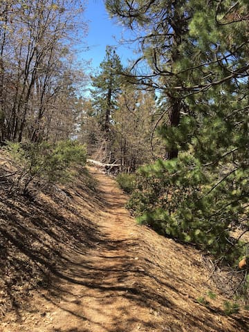
Exploration Trail (2W09X) Moderate 4.5 miles one-way
The Exploration Trail is a family friendly, non-motorized 4.5 mile trail with a 12% grade. This trail was designed by children
along with the U.S. Forest Service personnel and other professionals. During winter, the trail offers an exciting snowshoe or cross country skiing trek.
Exploration Trail
Exploration TrailExploration Trail (2W09X) Moderate 4.5 miles one-way
The Exploration Trail is a family friendly, non-motorized 4.5 mile trail with a 12% grade. This trail was designed by children
along with the U.S. Forest Service personnel and other professionals. During winter, the trail offers an exciting snowshoe or cross country skiing trek.
Tunnel II Trail (3W19) Easy 1 mile
The Tunnel 2 Trail begins at Forest Service Road 2N34. Take Grass Valley Rd. to Clubhouse. Follow Clubhouse to Fairway,
continue on Fairway, turning right on Brentwood. Turn left on Sonoma to 2N24A. Go left on 2N34A and park at the
intersection of 2N24A and 2N24, the trailhead is on right. This trail enjoys views of Miller Canyon and Lake Silverwood.
6 residents recomanen
Tunnel 2 Trail 3W19
598 Sonoma DrTunnel II Trail (3W19) Easy 1 mile
The Tunnel 2 Trail begins at Forest Service Road 2N34. Take Grass Valley Rd. to Clubhouse. Follow Clubhouse to Fairway,
continue on Fairway, turning right on Brentwood. Turn left on Sonoma to 2N24A. Go left on 2N34A and park at the
intersection of 2N24A and 2N24, the trailhead is on right. This trail enjoys views of Miller Canyon and Lake Silverwood.
4.5 miles each way, moderately difficult in Running Springs (12% grade). This trail will take you into some of the San Bernardino Mountains’ most beautiful country. This non-motorized trail crossing the 3,400 acre National Children’s Forest is open for use year round & is family-friendly.
The trail starts on Keller Peak Road (first right after Deer Lick Fire Station, traveling toward Big Bear) in Running Springs on Hwy. 18. The trailhead is on the right a little way inside the gate. (The gate is locked from the first snowfall until the road is completely thawed and cleared of obstructions in the spring.)
53 residents recomanen
Childrens Forest
32573 CA-184.5 miles each way, moderately difficult in Running Springs (12% grade). This trail will take you into some of the San Bernardino Mountains’ most beautiful country. This non-motorized trail crossing the 3,400 acre National Children’s Forest is open for use year round & is family-friendly.
The trail starts on Keller Peak Road (first right after Deer Lick Fire Station, traveling toward Big Bear) in Running Springs on Hwy. 18. The trailhead is on the right a little way inside the gate. (The gate is locked from the first snowfall until the road is completely thawed and cleared of obstructions in the spring.)
1 mile loop, easy walk in Sky Forest. This interpretive trail is located 2 miles east of Sky Forest on Highway 18. The trail is an easy walk for all ages that takes you through a self-guided tour with 25 points of interest about native plants and wildlife.
226 residents recomanen
Heaps Peak Arboretum Day Use Area
29358 Rim of the World Hwy1 mile loop, easy walk in Sky Forest. This interpretive trail is located 2 miles east of Sky Forest on Highway 18. The trail is an easy walk for all ages that takes you through a self-guided tour with 25 points of interest about native plants and wildlife.
Moderately difficult Hikes in Cedar Glen
Located on Hook Creek Rd. in Cedar Glen (off Hwy. 173) Drive to end of Hook Creek Rd. The road becomes a forest service dirt road. Stay left when the road forks. Soon you will see an open gate on the right leading to a ½ mile drive to the picnic & restroom area. An Adventure Pass is required to park at the trailhead. Follow the signs to Deep Creek and the Pacific Crest Trail. The Pacific Crest Trail stretches from the Mexican border to the Canadian border so you can choose your own distance on this one.
9 residents recomanen
Splinters Cabin Day Use Area
Crab FlatsModerately difficult Hikes in Cedar Glen
Located on Hook Creek Rd. in Cedar Glen (off Hwy. 173) Drive to end of Hook Creek Rd. The road becomes a forest service dirt road. Stay left when the road forks. Soon you will see an open gate on the right leading to a ½ mile drive to the picnic & restroom area. An Adventure Pass is required to park at the trailhead. Follow the signs to Deep Creek and the Pacific Crest Trail. The Pacific Crest Trail stretches from the Mexican border to the Canadian border so you can choose your own distance on this one.
2.5 mile loop, easy walk
This lakeside trail begins from the back of the South Beach Parking area in Lake Gregory Regional Park. From Highway 18, take Lake Gregory Drive to San Moritz Drive. Turn Right on San Moritz and look for the Parking area on your left. This is a great hike for dogs.
216 residents recomanen
Parc Regional del Llac Gregory
24171 Lake Dr2.5 mile loop, easy walk
This lakeside trail begins from the back of the South Beach Parking area in Lake Gregory Regional Park. From Highway 18, take Lake Gregory Drive to San Moritz Drive. Turn Right on San Moritz and look for the Parking area on your left. This is a great hike for dogs.
Dining
The Lakefront Tap Room Bar and Kitchen opened in July 2016 and is located inside The Lake Arrowhead Village. Since then, we strive to keep our menu fresh with new culinary selections every season, a constantly rotating tap list and craft cocktails designed by our mixologists.
The Lakefront's location was completely built and redesigned from the ground up, Merging two spaces; an old book store turned into our kitchen and the previous coffee shop became our main dining area. We also have a patio area featuring panoramic views of the lake perfect for dining on summer afternoons!
We also host live music on Fridays and sometimes Saturdays as well as community events like paint nights so check out our events calendar!
303 residents recomanen
The Lakefront Tap Room Bar and Kitchen
28200 CA-189The Lakefront Tap Room Bar and Kitchen opened in July 2016 and is located inside The Lake Arrowhead Village. Since then, we strive to keep our menu fresh with new culinary selections every season, a constantly rotating tap list and craft cocktails designed by our mixologists.
The Lakefront's location was completely built and redesigned from the ground up, Merging two spaces; an old book store turned into our kitchen and the previous coffee shop became our main dining area. We also have a patio area featuring panoramic views of the lake perfect for dining on summer afternoons!
We also host live music on Fridays and sometimes Saturdays as well as community events like paint nights so check out our events calendar!
The Grill At Antlers Inn
26125 CA-189The Grill At Lake Arrowhead
28200 CA-189Santiago's Taco Shop
27226 CA-189Recomanacions sobre la ciutat
Costums i cultura
Let's Keep the Mountain Clean!
The locals complain about visitors because when they visit, they leave trash everywhere. Do your part to help keep the mountain clean and take your trash with you. In fact, you can help out by picking up any trash you see around the mountain or lakes.
Com moure's per aquí
Snow Part 1
When a storm comes in, the weather can be unpredictable. It could be just rain or a couple of feet of snow. So here is some information that is meant to help you be prepared for the weather.
San Bernardino County is responsible for keeping the highways clear up the mountain. Typically the roads do get plowed, but depending on how much snow and incidents/accidents, it can take some time to clear. Unfortunately, we have no control over what happens to the roads on your drive up.
Com moure's per aquí
Snow Part 2
We would highly recommend that you have an all wheel drive vehicle and snow chains when driving up during snowy weather conditions. The highways will most likely require chains in order to even start heading up the mountain (highway patrol will stop you and not let you go up if you don't have chains). Also, traffic can be very slow when there is snow on the mountain roads... again very unpredictable.
There is a possibility of road closures as well but this is usually when is snows a lot (I would check the Caltrans website for road closures before heading up).